Free Photos (Public Domain Photos),stock Photos, Clipart, images, and Vectors

A large Public Domain photo repository with high resolution free photos and vectors. All copyright free stock photos and royalty free photos, and CC0 Photos. 27000 free and public domain photos, images, clipart, pics and vectors and counting. To view/download a photo in high resolution, please click on the image.

Sponsored Images via Shutterstock: Coupon Code: GFP15 for 15% off
Maryland, U.S. state, gray political map with borders and county names. State in the Mid-Atlantic region of the USA, subdivided into 23 counties and the independent City of Baltimore. Old Line State
Maryland Map with editable stroke icon. Maryland USA State thin line icon, Maryland map vector illustration, Maryland, MD blue silhouette vector map
A Beautiful Winter Afternoon at the Inner Harbor, Baltimore Maryland USA
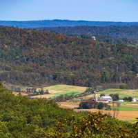
Idyllic Autumn landscape in historic Cumberland Maryland
Maryland State Capitol Line Icon. Annapolis, Us Color Symbol, Silhouette, Editable Stroke.
Normal flag of the United States of America federal state of MARYLAND

Maryland is one of the original 13 colonies and is one of the smallest and most densly populated states. Maryland also has the highest household income of any state and has landscapes ranging from the ocean to its high point at Hoye's Crest. These are free public domain photos from the state of Maryland.